At the outset of our journey, I was only worried about one thing: making it through a complex section of the loop before it got dark. In particular, I’d heard that finding the trail again after the final road section was tough even in the daylight.
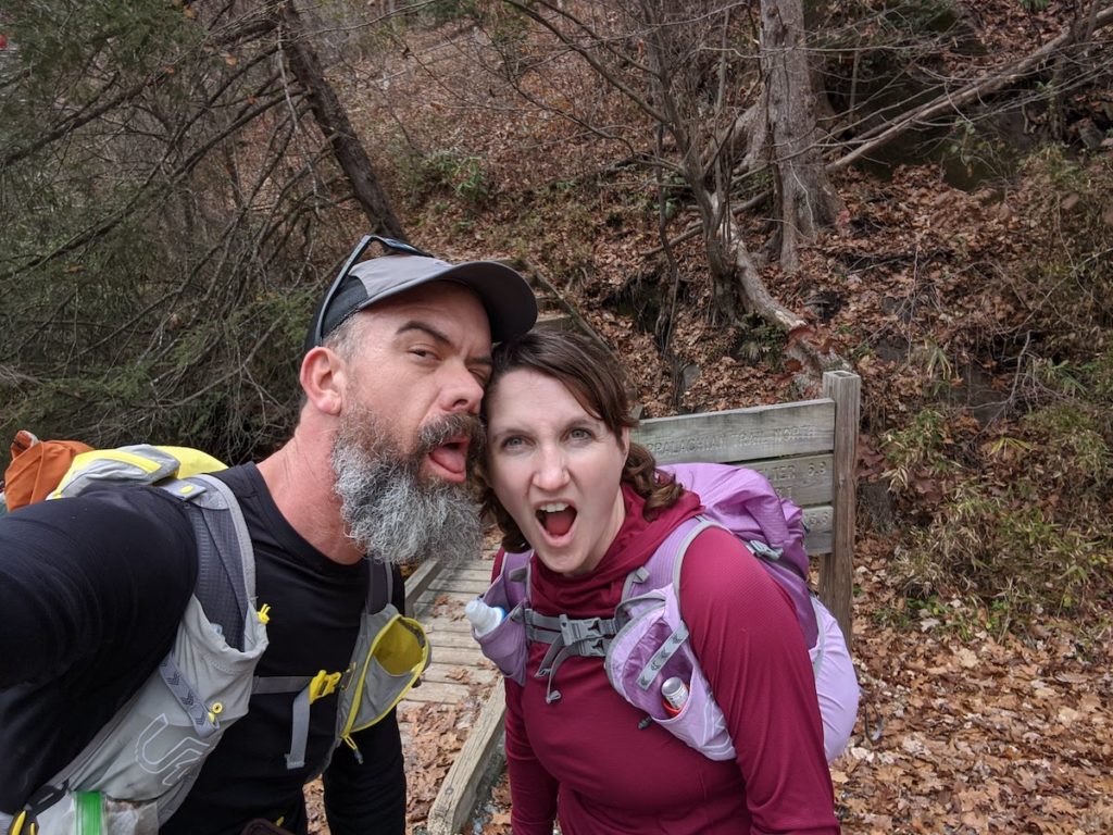
The loop was the Nantahala Adventure Run near Bryson City, NC: 56ish miles comprised mostly of the Bartram Trail but beginning and ending on the AT. Total vertical gain for the loop ended up being a stout 14k feet. Our plan was to cover as much of it as we could take the first day, bivy for a few hours, and then finish it up the following day. We parked our campervan at Nantahala Outdoor Center, a fantastic outfitter that caters to both the river community and hikers on the AT.
We got on the trail earlier than planned the next morning, and were most of the way up the 9 mile climb to Cheoah Bald by the time the sun rose. The day dawned into trail perfection: bluebird sky, upper 40s, nice light breeze. We were northbound AT-wise and we met a couple of sobo thruhikers who were less than 150 miles from Springer Mt. At the top of Cheoah, 9 miles into the loop, we picked up the Bartram Trail.
The difference between the AT and Bartram was immediately apparent. The Bartram showed little signs of recent travel, and the leaf cover was much more dense and less packed. Before the end of the trip the soothing sound of leaves underfoot would become something we didn’t want to hear again for a few months.
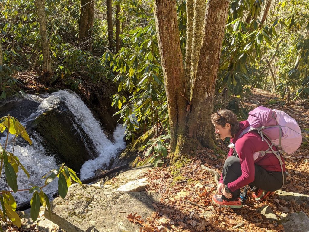
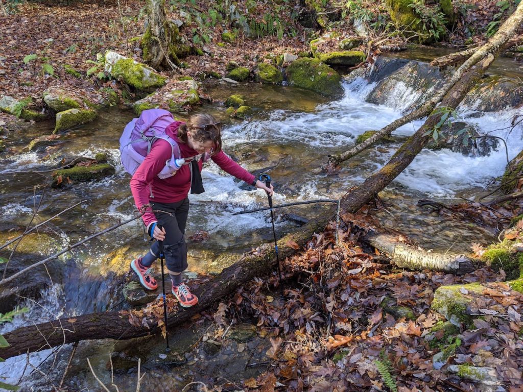
The first section of the Bartram is the steepest of its whole 116 miles, so we were glad we were descending (the second-steepest section still lurked ahead of us). Besides mountain vistas, descending the next 7 miles was the most beautiful part of the loop. We crossed Ledbetter Creek many times and got a good look at the magnificent Bartram Falls. We saw the only other people we encountered on the whole Bartram stretch, a couple and their kids hiking to the falls. Close to the Nantahala, the trail became harder to follow in sections and was frequently obstructed by blowdowns. After crossing the Nantahala, we were treated to a few miles of paved bike path and then a nice logging road up and over Rattlesnake Knob.
Somewhere in here our chances of making it to the turn I was worrying about before nightfall dwindled. We were moving steadily, but wrong turns, navigation stops and blowdowns were adding up. Clouds moved in and the barometric pressure drop alert on my watch went off despite a zero precip forecast.
We were traveling along the noisy Nantahala River, which is likely the reason I was able to walk past the bear without either of us seeing each other despite being only 30 yards or so apart. Allison was about the same distance behind me on the trail. The bear was big, likely bulked up for the season. I shouted to Allison to alert her, but she was already looking into the rhododendrons trying to figure out what was making the sound. The bear looked up at me, then looked at Allison, and for a moment I thought he was going to run between us. He opted to crash through the underbrush in the opposite direction, though, disappearing quickly into the dusk.
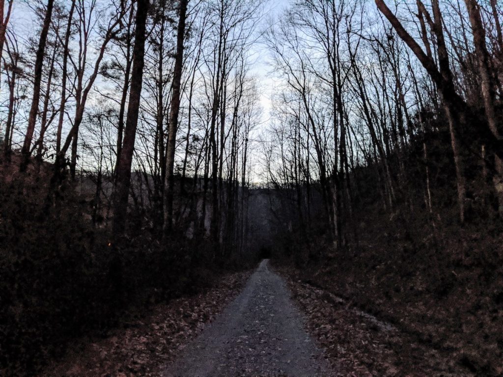
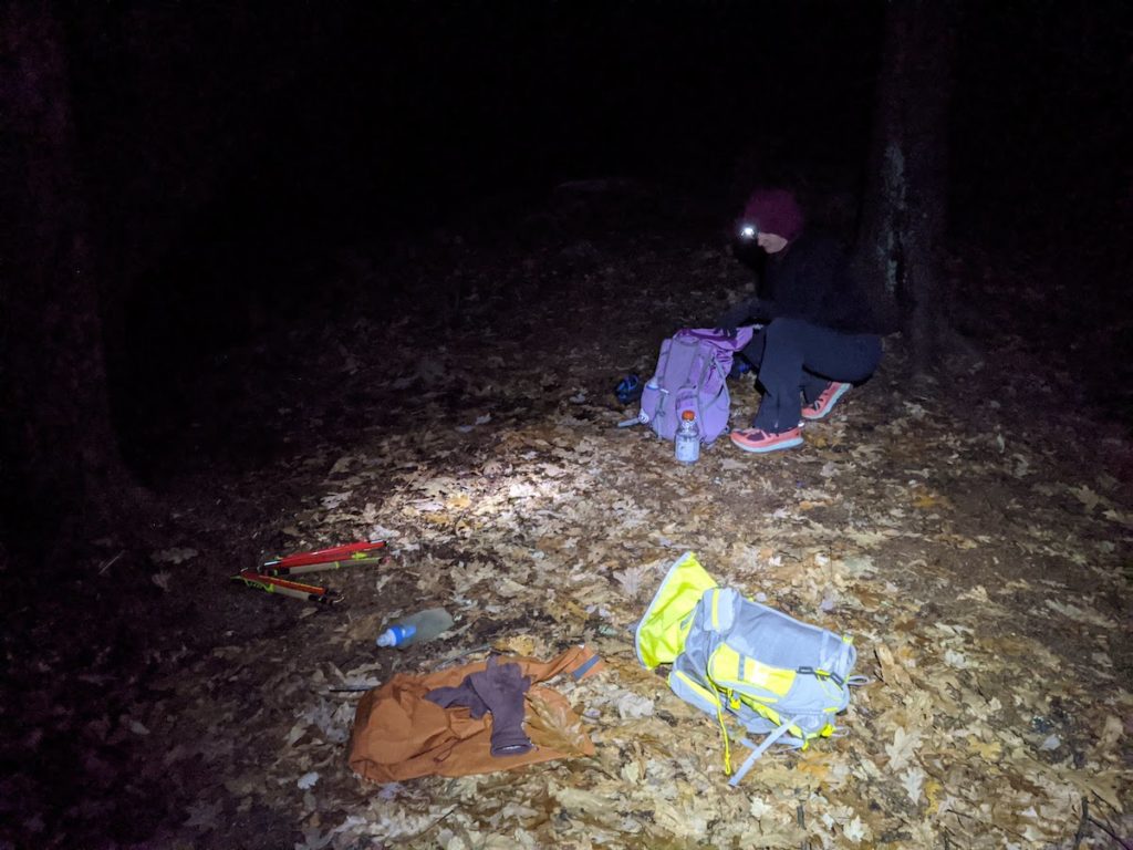
It was dark soon after, and our progress slowed as we navigated the frequent trail/jeep track intersections by headlamp. We watched the two day old horned moon turn orange and set behind the mountains. I asked Allison when the Type 1 fun would turn to Type 2, as I was having a pretty damned good time.
When we hit the mile of pavement I immediately started scanning the trees with my headlamp, looking for a blaze that would mark our return to proper trail for the remainder of the miles. We passed a closed restaurant and a few houses, windows convivally lit, likely with people inside enjoying their post-Thanksgiving activities. I wondered, not for the last time, if we should take up a different hobby.
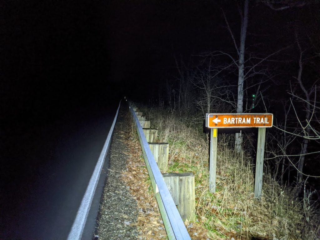
The sign marking the turn back into the woods, the turn I’d been worried about for days, was the sort of thing designed to be read by motorists from 200 yards away while driving 60mph. We both laughed with relief: of all the intersections we’d just navigated, this was the only one which didn’t even require a map check. One of the most basic rules of long distance foot travel is that the thing you’re worried about is almost never the thing that causes the real problem. I have been taught that lesson repeatedly, but I was about to learn it again.
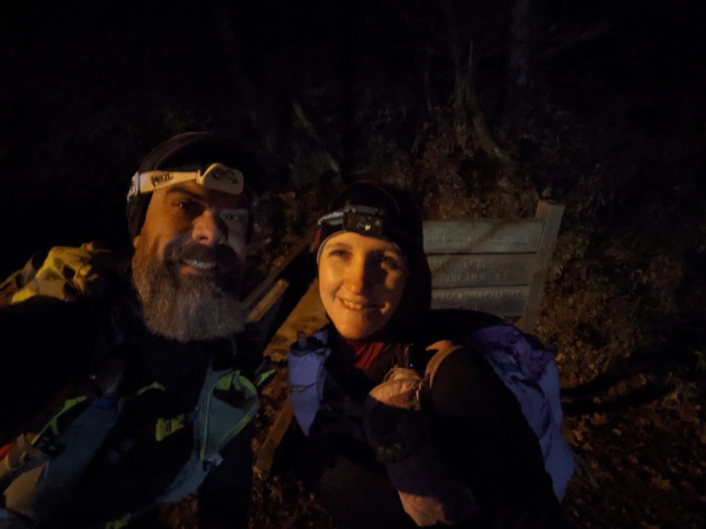
The next 3.5 miles ascending Jarrett Bald took us 2.5 brutal hours and was by far the crux of the whole loop. The trail followed the ascending ridge directly for 1800’ of gain, and there wasn’t room for switchbacks, so the way up was unrelenting, oftentimes slick, and sometimes scrambly. Our headlamps illuminated the narrow ridge, vanishing into the blank, open drops on either side. It felt somehow both exposed and claustrophobic in turns, sometimes simultaneously. By the time we reached the top of Jarrett we were demoralized and quiet. We sat in the dark on a log near an old campsite as the cold breeze dried our sweat. It was 2200 and we’d come about 33 miles. The original plan was to have Thanksgiving dinner — pumpkin spice Cliff bars and turkey sausages — on Jarrett then continue on the Wine Springs Bald to bivy. Neither of us wanted to do either. We ate a little then climbed into our bivy sacks with the intention of starting moving again at 0200. It was nearly 2300. Less than an hour later, I woke to rain on my face. I zipped my bivy closed. It was still raining when I woke up at 2, and the thought of getting back on the trail was painful. Jarrett Bald had properly wounded us. I fell asleep once again contemplating a hobby change.
I woke up again at 0430 and the rain had vanished, taking my excuses with it. I woke Allison, and we got back on the trail. After a couple of miles working out the stiffness, we began to move more quickly. The day dawned grey and cool, with most of the vistas obscured by mist. Despite the heavy clouds, the rain held off, and the drama of Jarrett Bald remained by far the most trying part of the trip. We crossed Wine Springs Bald, then Wayah, looking back far across the valley at where we’d come. Then the long, though far from consistent, down began. Nearly a mile from the NOC, we smelled the restaurant and heard the rushing Nantahala again, which quickened our steps considerably. We finished the loop 32 hours and 55 minutes after we’d started.